THE ESCALANTE PROJECT
Located in south central Utah, the Grand Staircase, Escalante National Monument encompasses over 1,870,000 acres of land. Within this massive area of land is an area known as the Escalante Canyons and the infamous Escalante River.
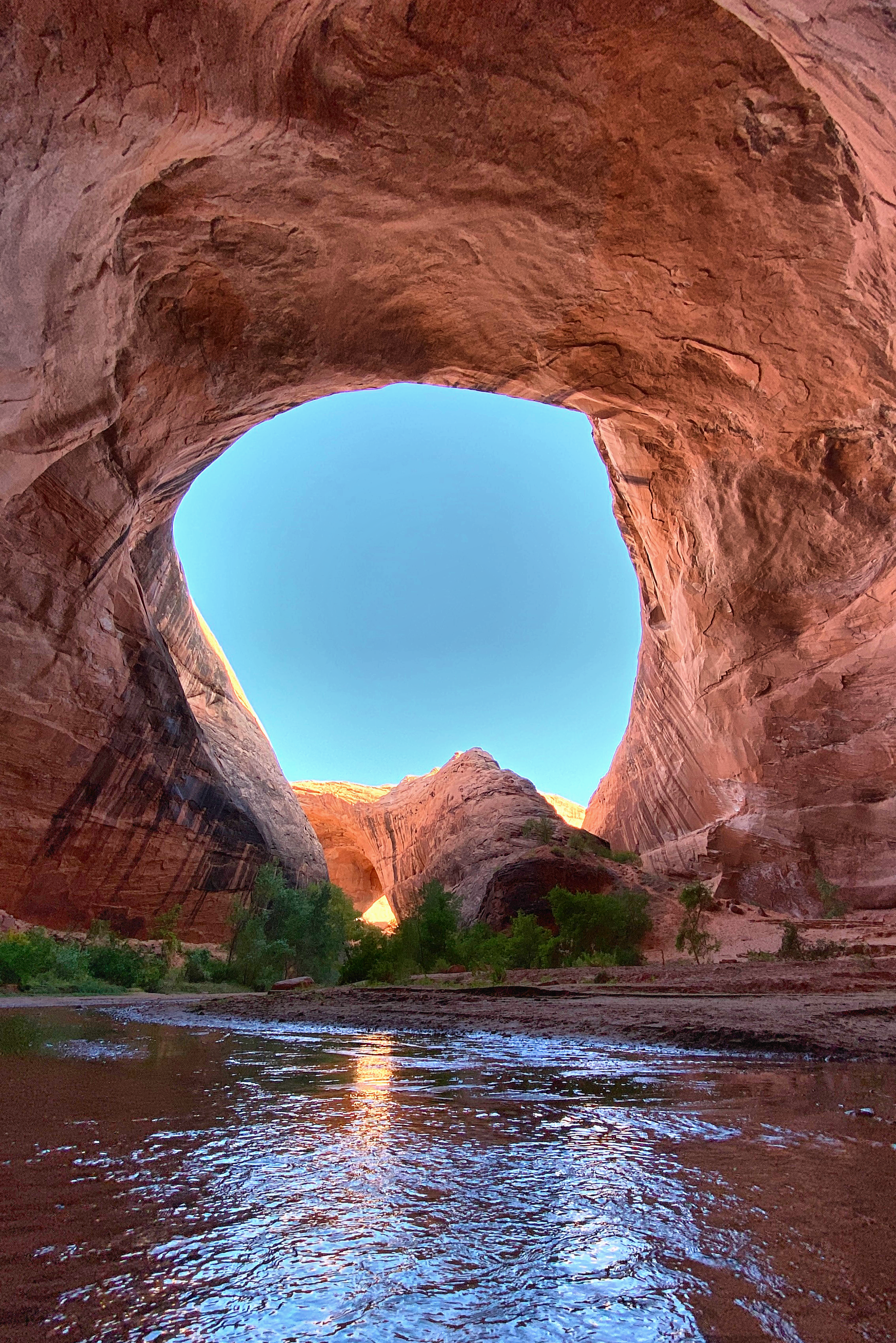
I was first introduced to this area as a young teenage boy. A youth leader of mine took a group of us boys to a canyon, quite unknown at the time, called Coyote Gulch. It was backpacking through the canyon and arches of Coyote Gulch that my passion for the Escalante River and the surrounding canyons was born.


EXPLORING THE ESCALANTE
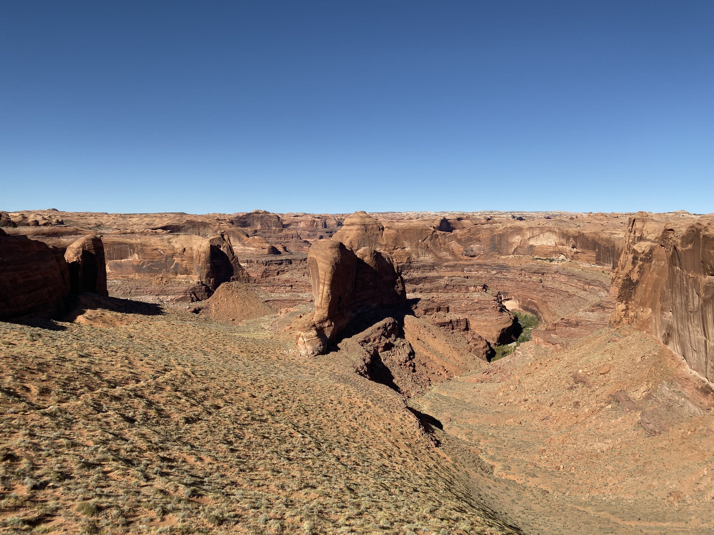
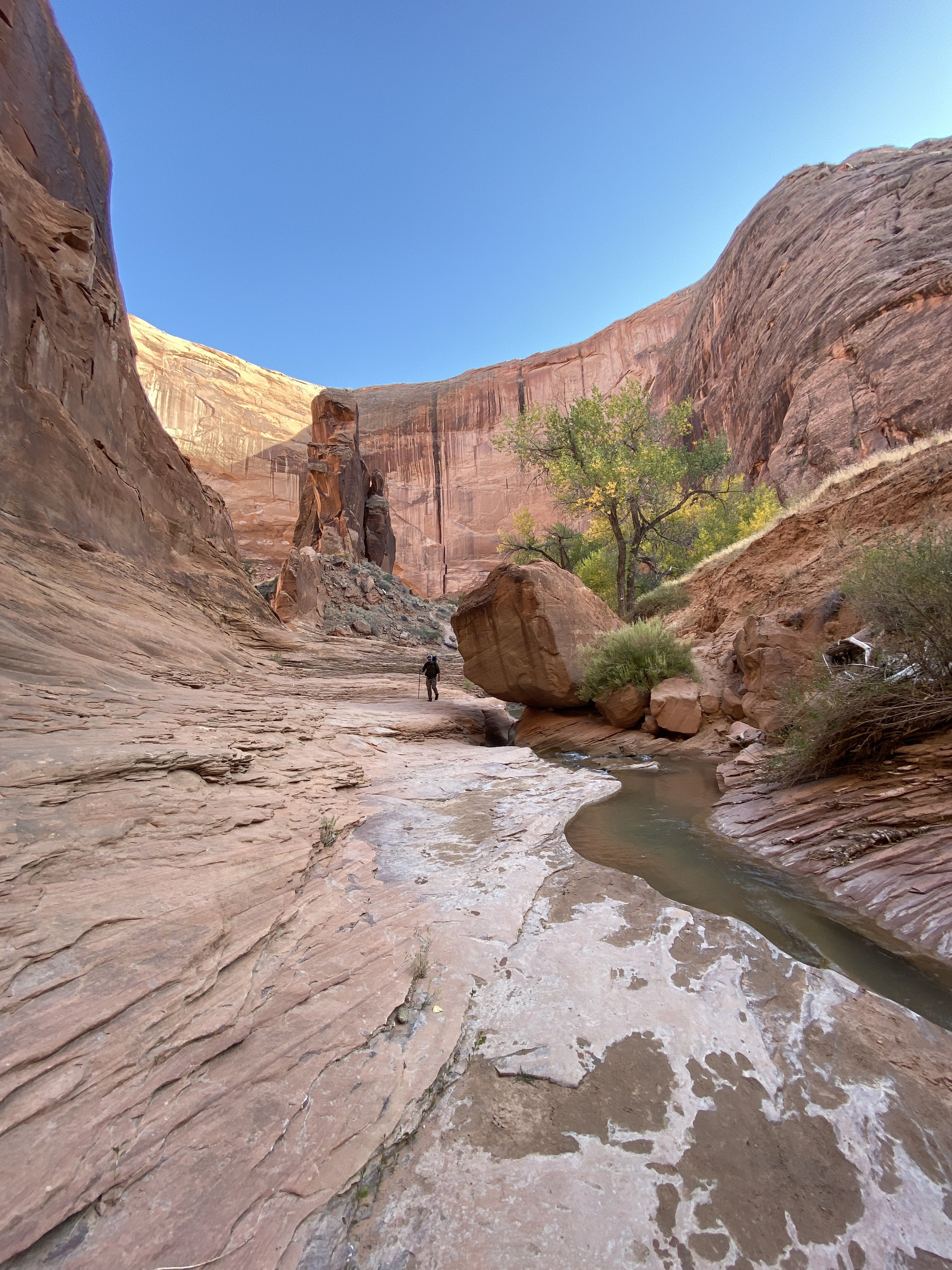
A tributary of the Colorado River, the Escalante River stretches approximately 90 miles from the town of Escalante and eventually connects to Lake Powell. Within the river corridor there are 26+ major drainages of canyons that connect to the main river canyon. Some of these canyons are well traveled, popular hiking routes, while others are rarely explored and full of thick brush making travel difficult. The surrounding plateau also dotted with smaller canyons that connect to these major drainages.
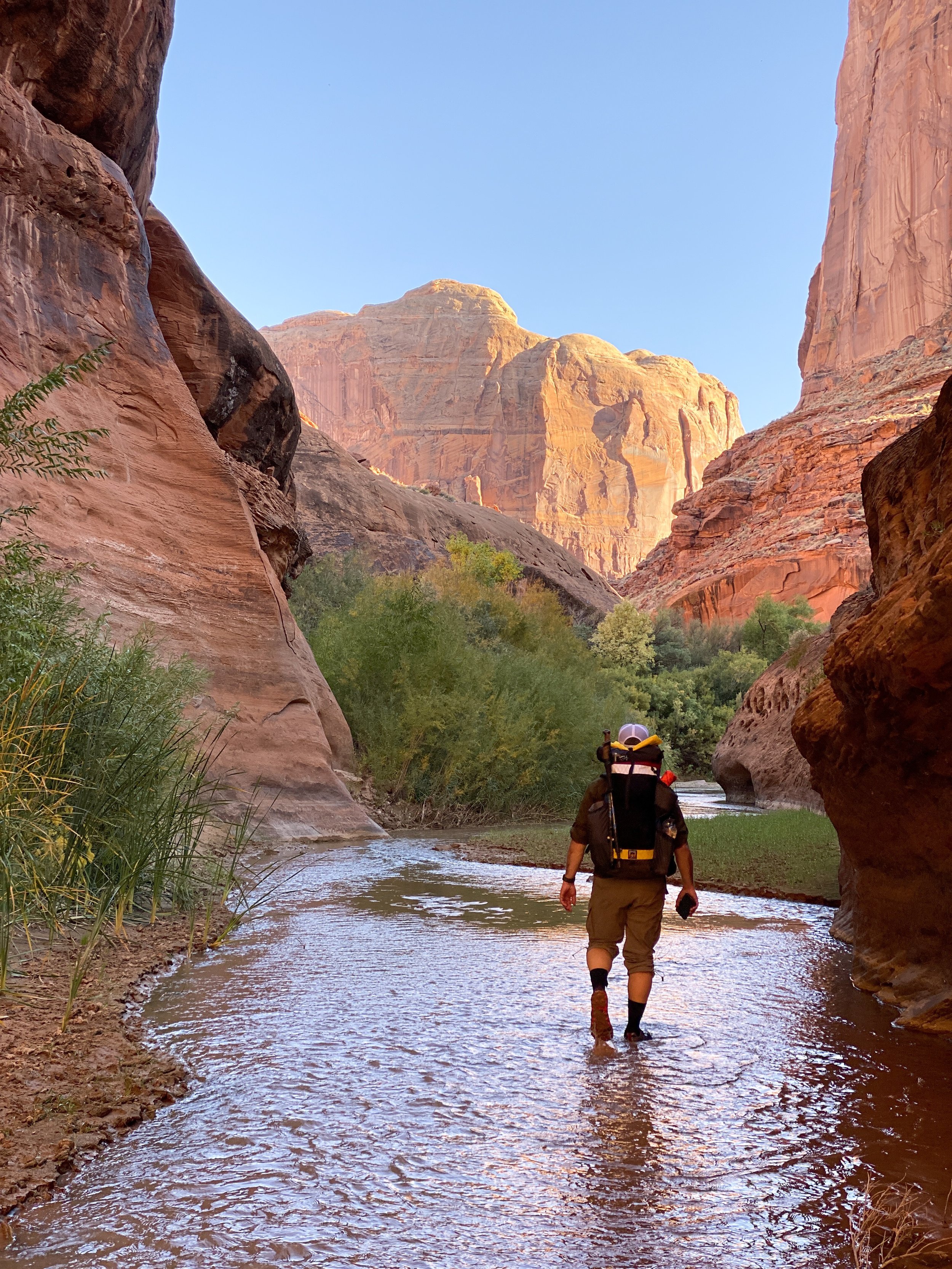
THE PROJECT: My goal is to explore as much of the Escalante canyons as makes sense to explore. Meaning that I will be hiking all of the major drainages from the top down, and exploring as many of the side canyons as possible as well. Additionally I will walk as much of the length of the Escalante River as possible. This will be done by connecting river sections as I explore canyons that enter into the river corridor.
With the Escalante River being a bucket list river for many to pack raft, I also have the goal to pack raft the river from the traditional highway 12 put in, and to raft to the buoy within Lake Powell that makes the confluence of the Escalante River with the Colorado River/Lake Powell. At which point I plan to swap boats to a touring kayak and paddle to Glen Canyon Dam.
Completed Sections As Of 12/2023
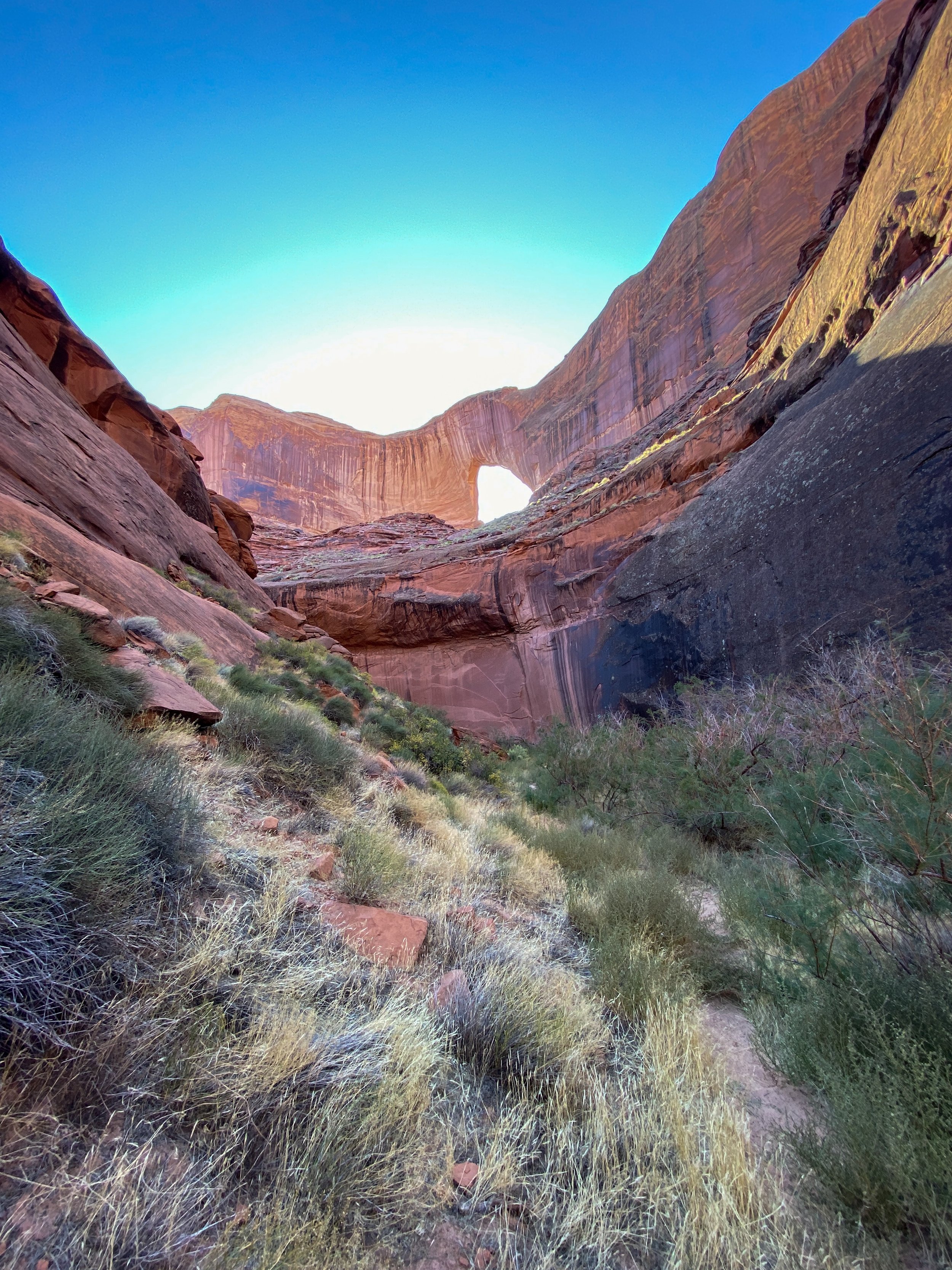
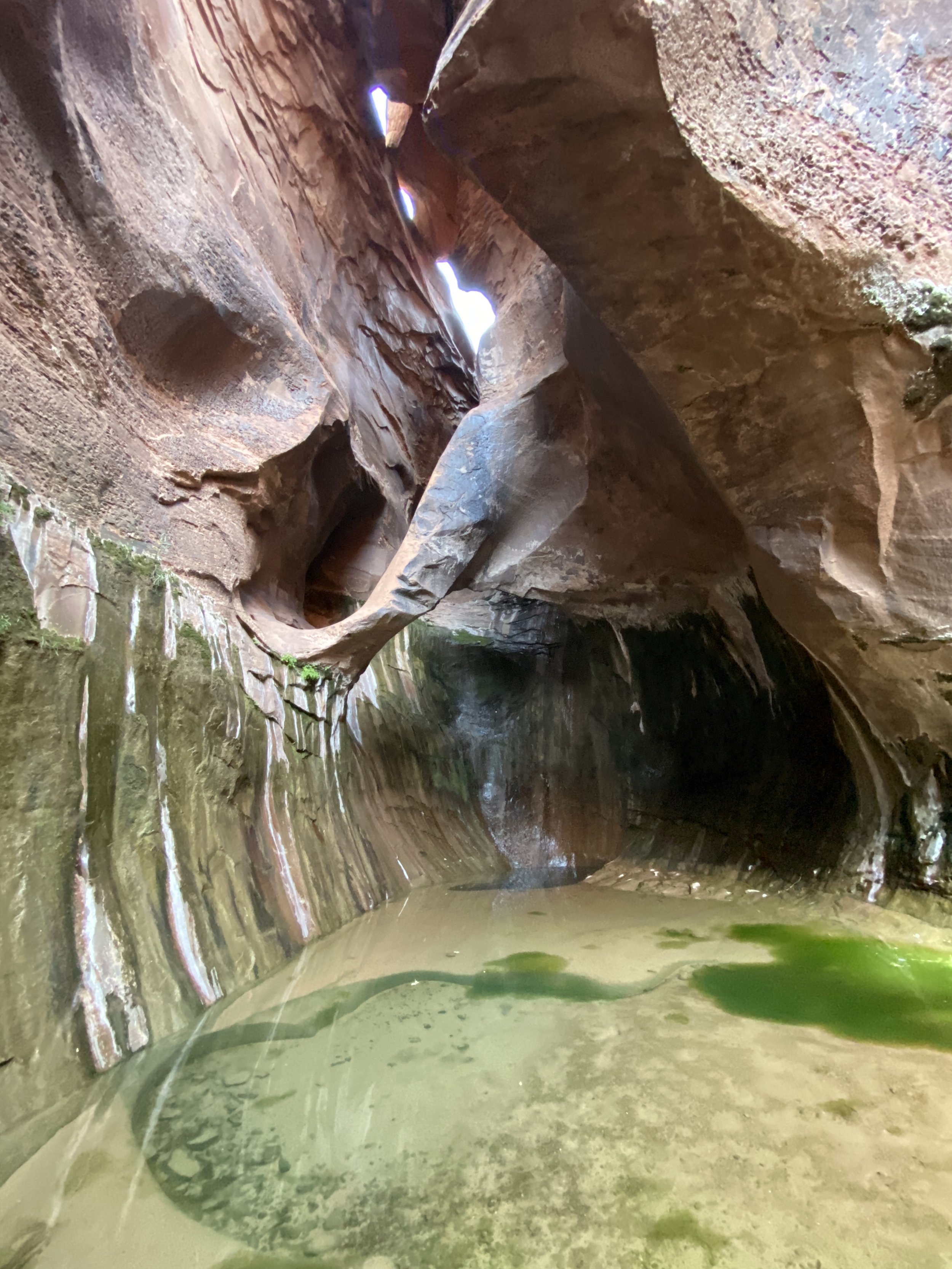
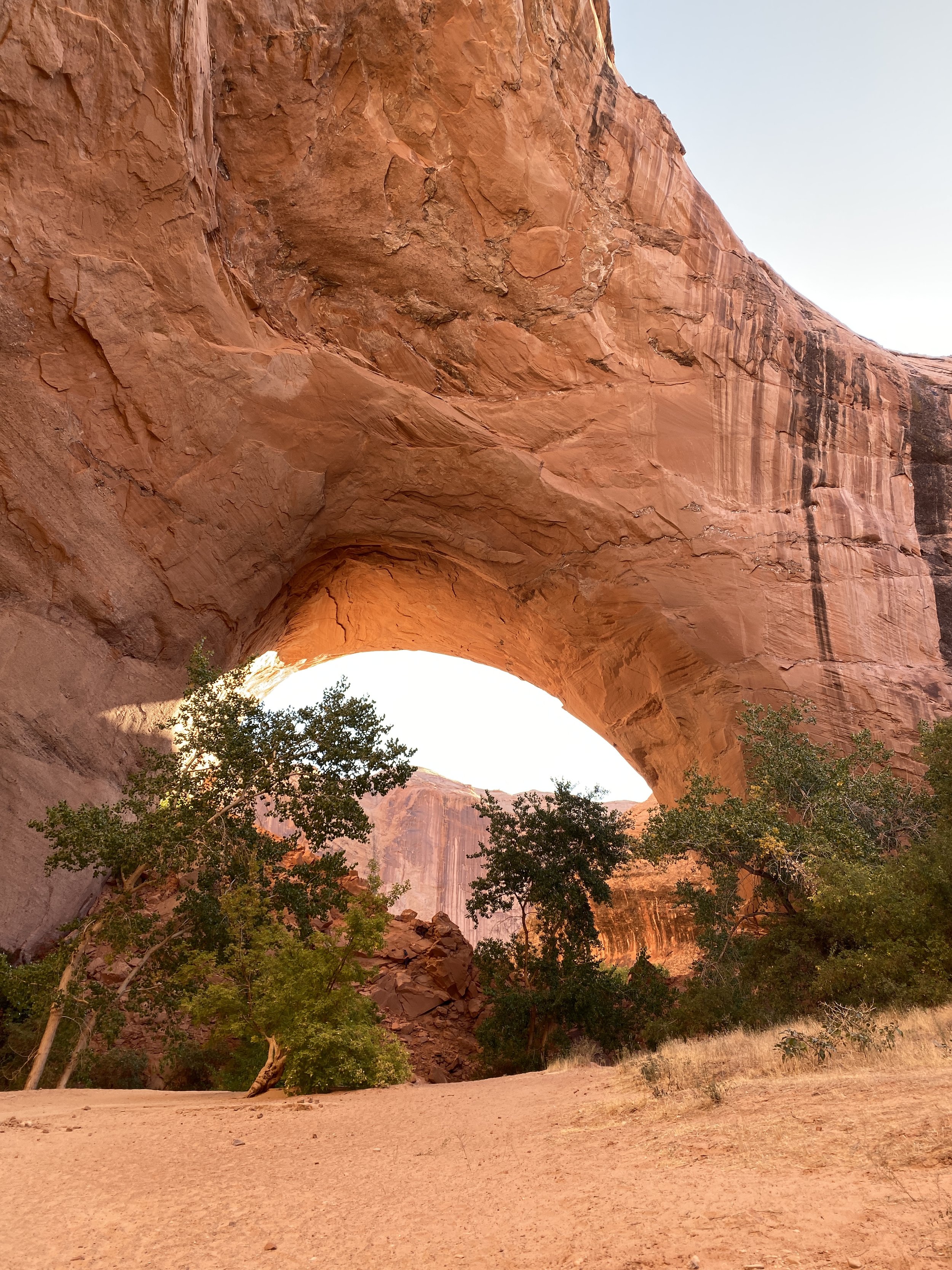
Coyote Gulch: (Fall 2019) Forty Mile Ridge TH to Crack In The Wall > Coyote Gulch confluence with the Escalante River > Up river to Stevens Canyon > Up Stevens Canyon to The Grotto > Return to Coyote Gulch and up the gulch to Jacob Hamblin Arch > Exit out sneaker route from Jacob Hamblin Arch to water tank trailhead.
Silver Falls to Chop Rock Loop: (Fall 2020) Silver Falls TH down canyon to Escalante River > Down the Escalante to confluence with Chop Rock Canyon > Up Chop Rock staying in main canyon > Side trip up North Fork of Chop Rock > Loop around top end of Chop Rock over Silver Falls Bench to Silver Falls TH.
Little Death Hollow/Wolverine Canyons Loop: (Fall 2021) Little Death Hollow TH down canyon through main narrows > Exit Little Death Hollow > Horse Canyon to Wolverine confluence > Up Wolverine Canyon to right fork of Wolverine > Looping back to Little Death Hollow TH.
Death Hollow via Boulder Mail Trail: (Multiple Trips) Boulder Mail Trail TH to top of Death Hollow > Down Lower Death Hollow to Escalante River confluence > Down Escalante River to Highway 12
Upper Escalante River Canyon: (Multiple Trips) Upper Escalante River TH (Town) > Down canyon to Death Hollow confluence > Side hike up Death Hollow to narrows > Death Hollow to Sand Creek > Sand Creek to Highway 12 TH
Harris Wash to Fence Canyon: (April 2018) Harris Wash TH down canyon to Escalante River confluence > Escalante River to Chop Rock Canyon > Chop Rock to Fence Canyon > Out to Egypt TH
Boulder Mail Trail to Sand Creek: (Spring 2018) Boulder Mail Trail TH to Sand Creek > Down Sand Creek roughly 1.5 miles > Exit out due to brush and ice > Back to BMT TH
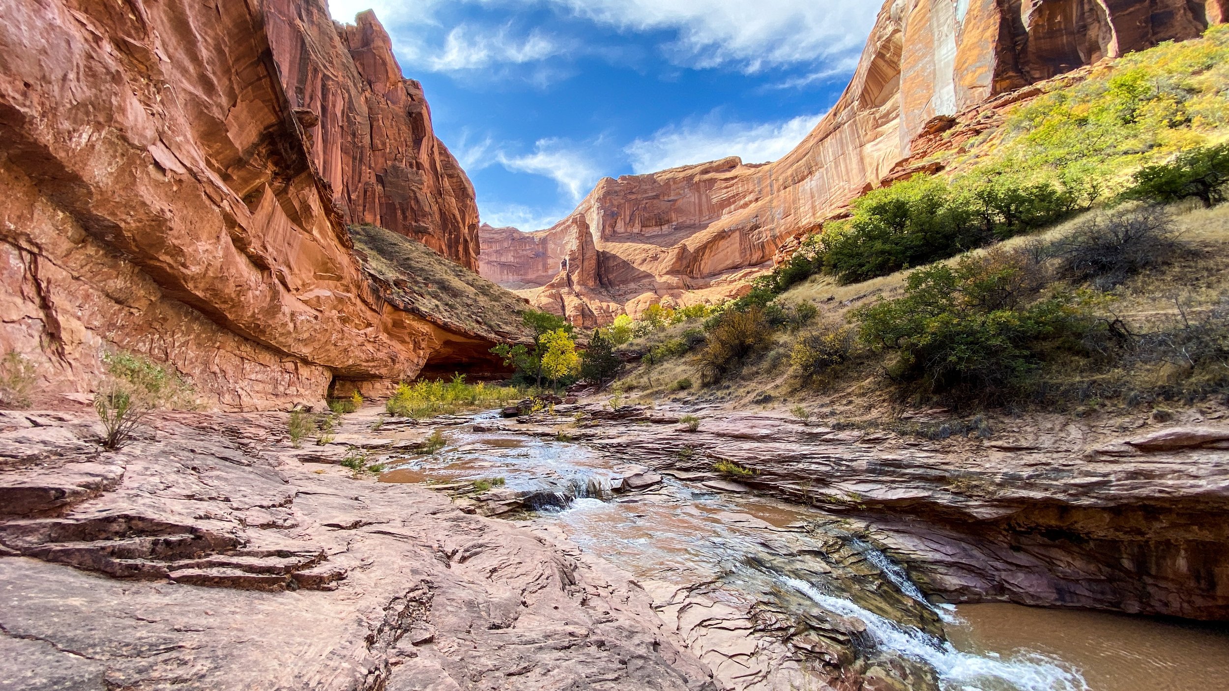
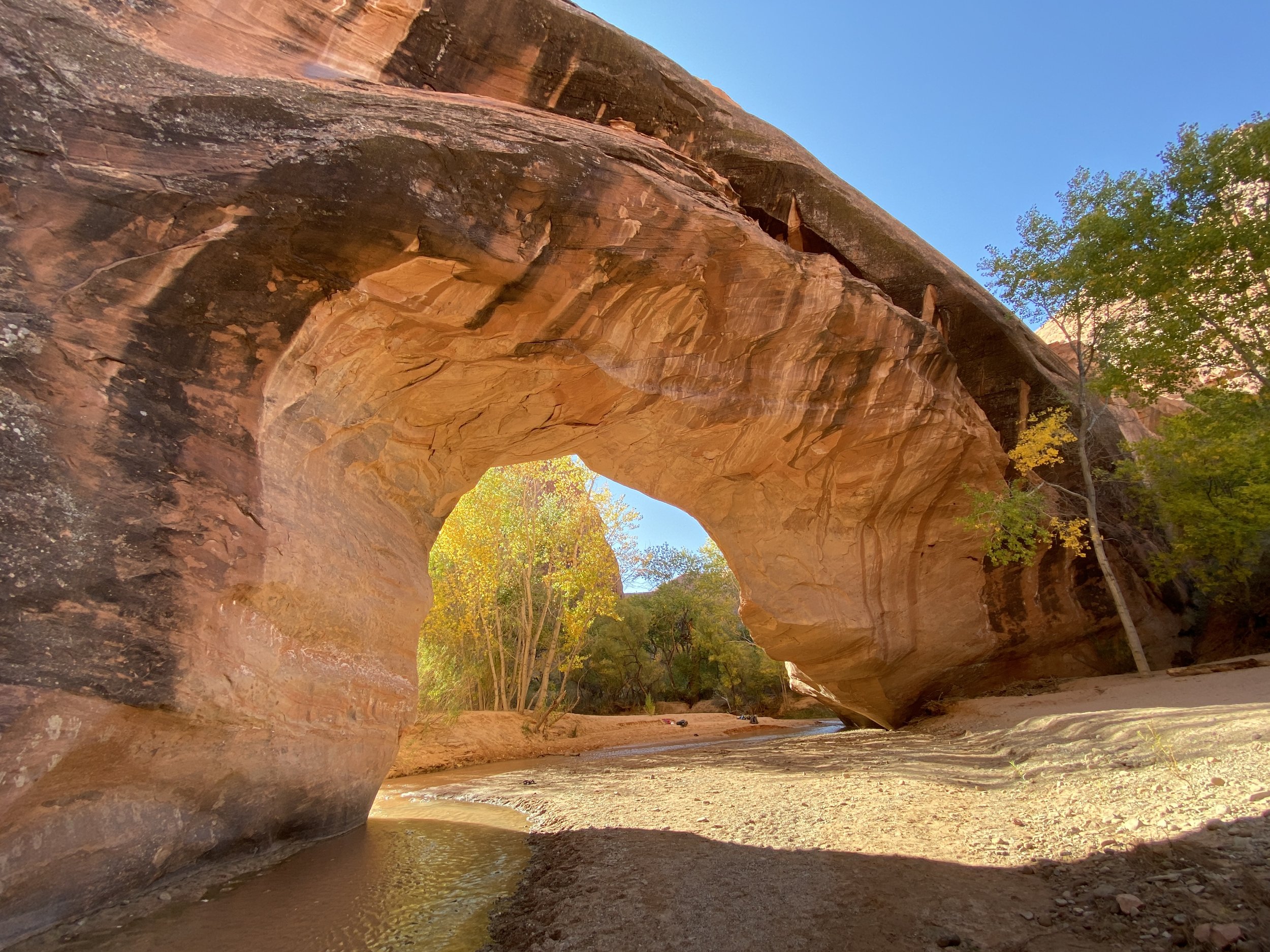
Fence Canyon to Neon Canyon: (Spring 2003) Egypt TH down Fence Canyon to Escalante River > Escalante River to Neon Canyon > Up Neon Canyon to the Golden Cathedral > Return to Fence Canyon and exit to Egypt TH